


A Lidar + RGB Solution for Aerial Surveying
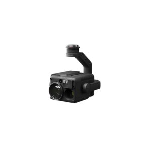
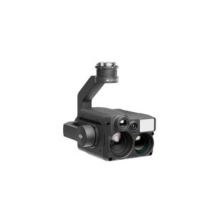
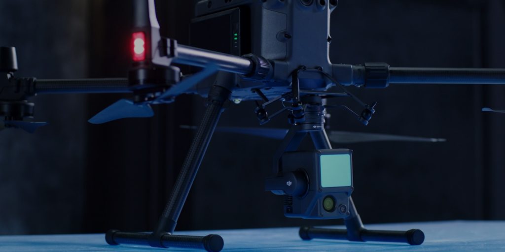
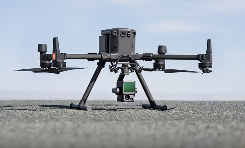
The Zenmuse L1 integrates a Livox Lidar module, a high-accuracy IMU, and a camera with a 1-inch CMOS on a 3-axis stabilized gimbal. When used with Matrice 300 RTK and DJI Terra, the L1 forms a complete solution that gives you real-time 3D data throughout the day, efficiently capturing the details of complex structures and delivering highly accurate reconstructed models.
REDUNDANCY SYSTEMS FOR SAFER FLIGHTS
The M300 RTK’s built-in advanced redundancy systems help keep your critical missions going even in unexpected scenarios.
PURPOSE-BUILT APPLICATIONS
HIGHLIGHTS
38 minutes tested flight time
Fully charge 2 TB60 batteries in 60 minutes using the BS60 charging station
IP45
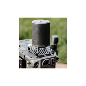
Anti-collision Beacon
15 Km Transmission Range
Mobile SDK Compatibility
Payload SDK
Onboard SDK
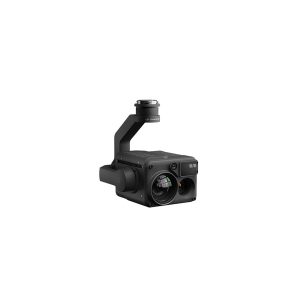
The Zenmuse L1 integrates a Livox Lidar module, a high-accuracy IMU, and a camera with a 1-inch CMOS on a 3-axis stabilized gimbal. When used with Matrice 300 RTK and DJI Terra, the L1 forms a complete solution that gives you real-time 3D data throughout the day, efficiently capturing the details of complex structures and delivering highly accurate reconstructed models.
KEY FEATURES
DIGITIZE WITHOUT COMPROMISE
Exceptional Efficiency
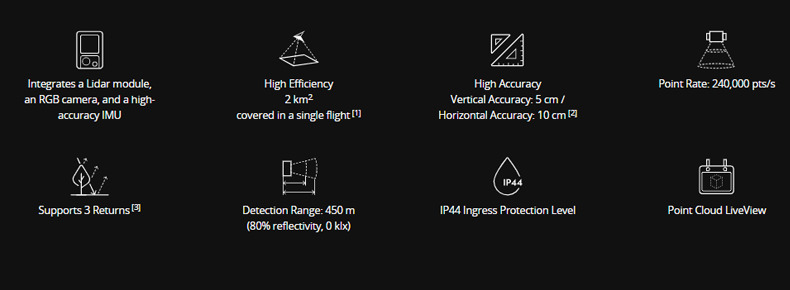
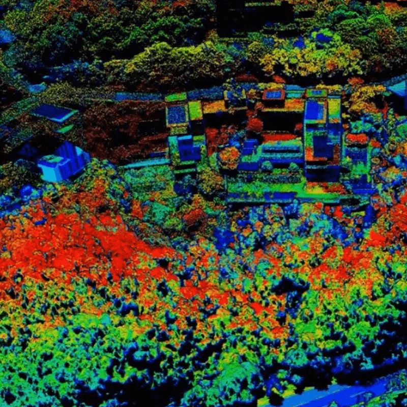
Generate true-color point cloud models in real-time, or acquire 2 km2 of point cloud data in a single flight [1] using the Livox frame Lidar module with a 70° FOV and a visible light camera with a 1-inch sensor.
Unparalleled Accuracy
Render centimeter-accurate reconstructions thanks to the high-accuracy IMU, a vision sensor for positioning accuracy, and the incorporation of GNSS data.
Ready When You Are
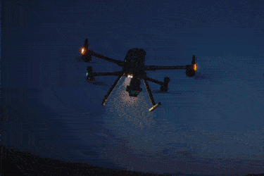
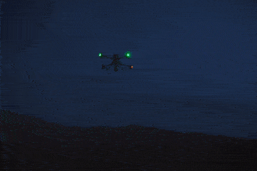
The IP44 rating allows the L1 to be operated in rainy or foggy environments. The Lidar module’s active scanning method enables you to fly at night.
VISUALISE DATA AS YOU FLY
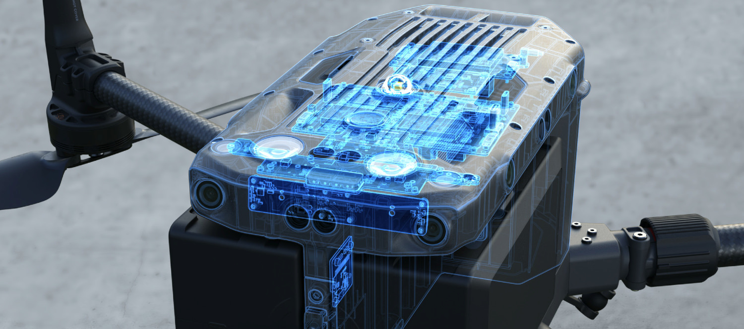
Livox Lidar Module
– Frame Lidar with up to 100% effective point cloud results
– Detection Range: 450m (80% reflectivity, 0 klx) / 190 m (10% reflectivity, 100 klx)
– Effective Point Rate: 240,000 pts/s
– Supports 3 Returns
– Line Scan Mode and Non-repetitive Scan Mode
EVERYTHING IN VIEW
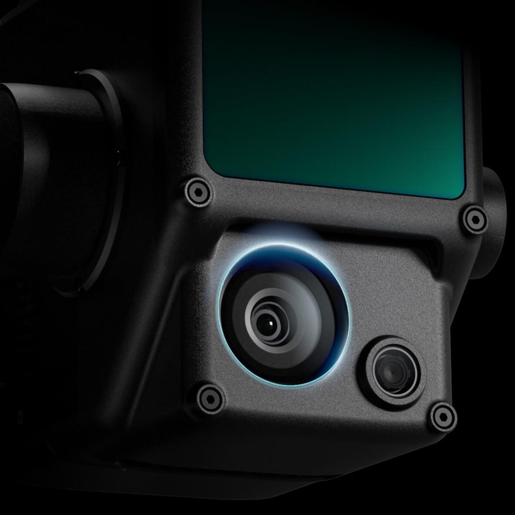
RGB Camera
– 20MP
– 1-inch CMOS
– Mechanical Shutter
ACCURATE DETAILS AT YOUR DISPOSAL
High-accuracy IMU
– Accuracy: 0.025° (roll/pitch) / 0.08° (yaw)
– Vision Sensor for Positioning Accuracy
– GNSS, IMU, RGB Data Fusion
RECREATE THE WORLD IN 3D POINT CLOUDS
Point Cloud LiveView
Real-time point clouds provide immediate insights onsite, so operators are informed to make critical decisions quickly.
You can also verify fieldwork quality by checking point cloud data immediately after each flight.
Measurement and Annotation
Acquire and communicate critical dimensions on the point cloud model using measurements and annotations.
One-stop Post-processing
DJI Terra fuses the IMU and GNSS data for point cloud and visible light calculations, in addition to conducting POS data calculations so you can effortlessly generate reconstructed models and accuracy reports.
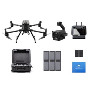
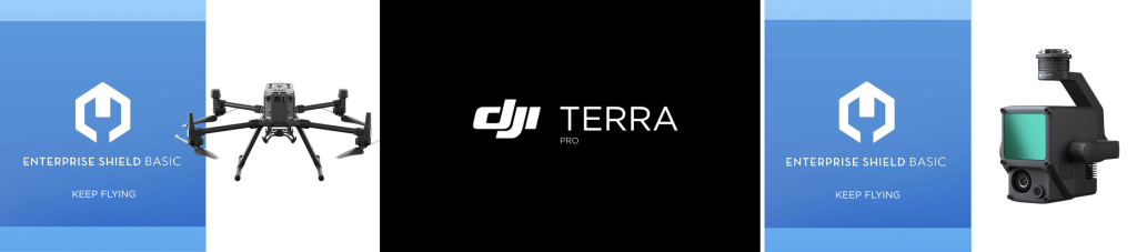
The DJI Matrice 300 RTK Lidar Package includes FREE Enterprise Shield cover on the Matrice 300 and Zenmuse L1, along with a 6-month DJI Terra Pro Subscription.
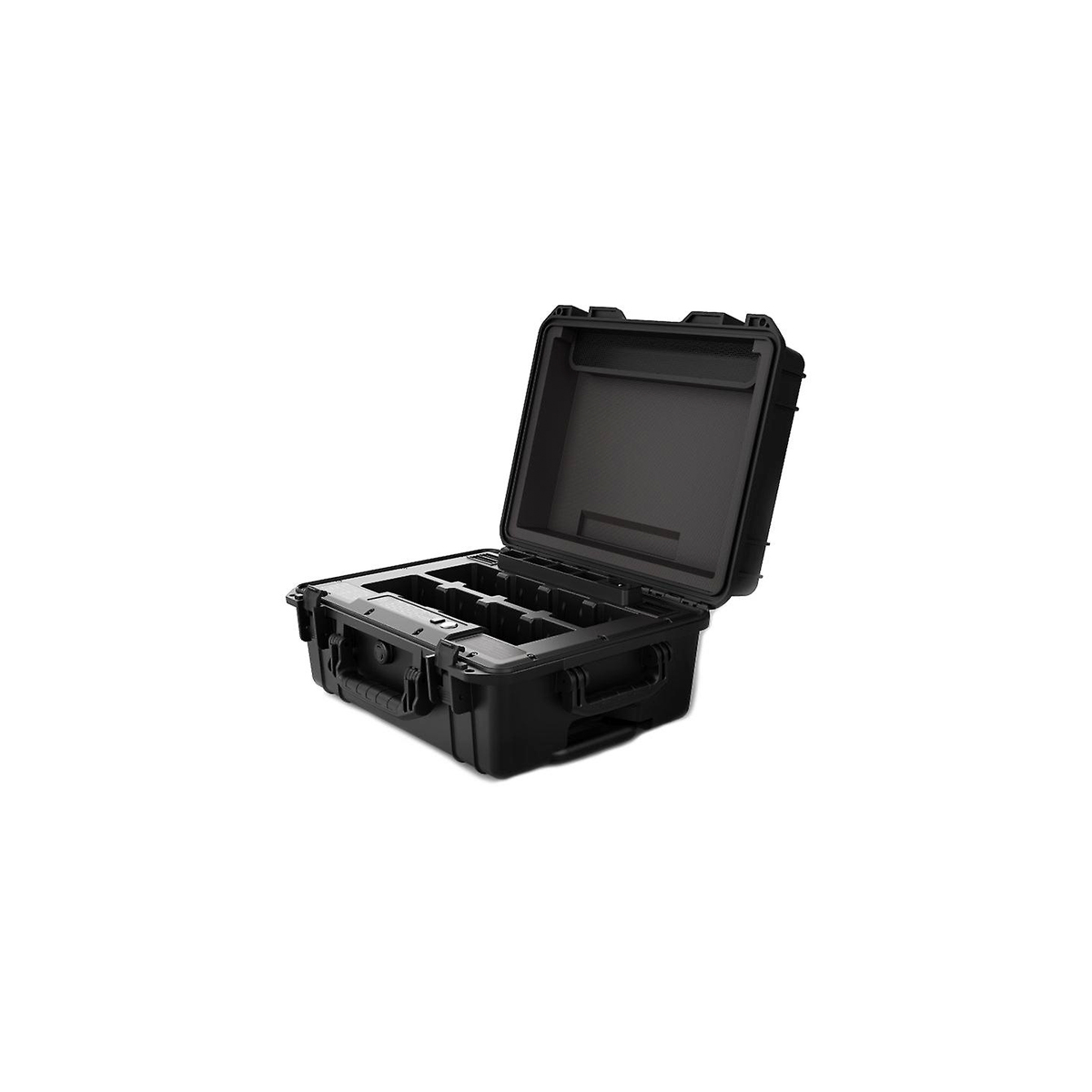
The DJI Matrice 300 RTK LiDAR Package comes with all the extras you need for a high-efficiency surveying package. Including the Zenmsue L1, three sets of TB60 batteries, two WB37 remote controller batteries, and a charging station to store and charge them all.
Optional Add-Ons