


FEATURES
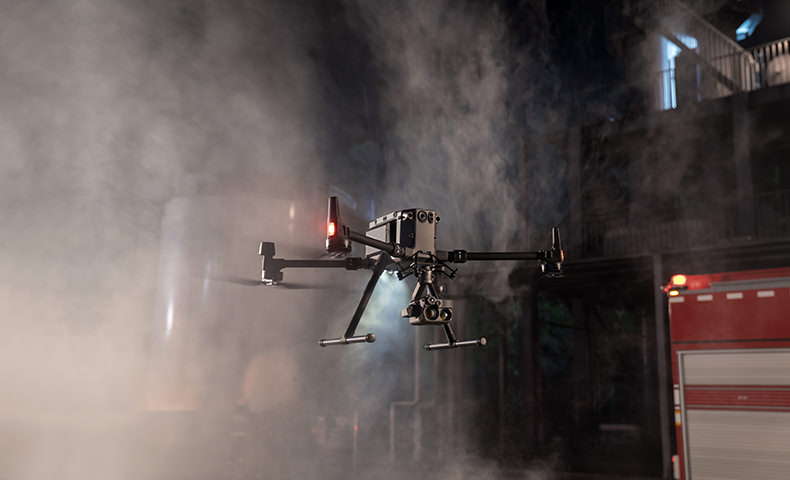
The Zenmuse H20N is the latest payload from DJI that is compatible with the DJI Matrice 300 RTK that give pilots vision beyond darkness. The Zenmuse H20N integrates starlight sensors into its zoom and wide angle cameras. Pairing this with dual zoom thermal cameras and a laser rangefinder, the H20N is now the most versatile hybrid payload on the market.
What are the image resolutions of the cameras?
Radiometric thermal camera: R-JPEG, 640×512 px
Wide-angle camera: JPEG, 2 MP
Zoom camera: JPEG, 4 MP
Key Features
20x Hybrid Optical Zoom and 128x Maximum Zoom.
2x, 8x Optical Zoom on Dual Thermal Cameras.
4 MP Nigh Vision Zoom Camera and 2 MP Night Vision Wide Camera.
Up to 1200m range for the Laser Rangefinder.
640 x 512 at 30 fps are the specifications of the thermal camera.
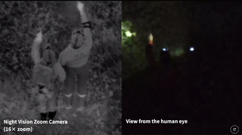
SEE THROUGH THE NIGHT
The zoom and wide-angle cameras are equipped with starlight sensors that are tailor-made for low-light environments.
INFRARED ZOOM
Two thermal cameras respectively provide 2× and 8× zoom, together enabling up to 32× zoom. Find hotspots and inspect in close detail after zoom-in.
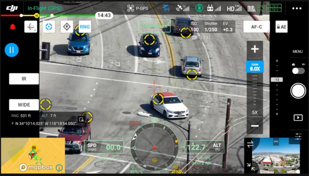
SYNCHRONIZED SPLIT-SCREEN ZOOM
H20N supports synchronized zoom between thermal and starlight night vision cameras. Users can scale both images at the same time. This doubles efficiency and makes it easier to compare details side by side.

INTELLIGENT FEATURES
ONE-TAP PANORAMA
Create 360 views of the site you are on with the one-tap panorama, perfect to capture the vision around the drone for easy surveying.
HIGH-RES GRID PHOTO
Frame an area of interest in wide camera view, and the zoom camera will automatically capture a set of 20 MP images of the area. These images are stored together with an overview image that can be viewed in greater detail.
PINPOINT
A quick tap marks an object in view, advanced sensor fusion algorithms immediately deliver its coordinates.
SMART TRACK
Identify and follow moving subjects like people, vehicles, and boats with the auto-zoom function, while continuously acquiring the subject’s dynamic location.
ACCURATE TEMPERATURE MEASUREMENT
Monitor the temperature of a site or an asset to eliminate any risks by acquiring a precise temperature reading from the air.
SPOT METER
Tap a point to get real-time reading of surface temperature.
AREA MEASUREMENT
Select an area to view the lowest, highest and average temperatures.